Still keeping mileage reasonable, but the climbing is increasing. Lots of hill repeats. A good base building week for sure. As the hills and speed increase, I must continue my physical therapy routine to keep my calves and shins healthy. Someday, I'll do a post on that torturous fun routine.
Sunday, December 18, 2011
Monday, December 12, 2011
Rapid River Intervals: "Jim Jones Koolaid"
koolaid (as defined by urbandictionary.com)
Cyanide laced drink used by cult leader Jim Jones in the 1978 mass suicide of 1913 people in French Guyana. The term "drink the koolaid" is commonly used to infer acceptance or belief in things that are ridiculous.
 |
| J. Jones RIP |
Each winter when the McCall trails are buried, I make several trips north 40+ miles to Rapid River near Riggins, ID. Here, at lower altitudes (TH at 2200') the trails are runnable for several miles all winter long. The trail begins in a near desert state climbing through gorgeous limestone bands and following sometimes luscious river bottom terrain. Nearly four miles into the run, the Rapid River splits giving access to 2 high quality trails travelling high into the alpine wilderness. The East Fork travels south 15 miles towards its headwaters on Pollack Mountain (8048') near New Meadows. The West Fork travels north about 12 miles and climbing past 8000' terminating in the Seven Devils Mountains above Hell's Canyon.
For a December run, I have been lucky to get up there twice in the past three days to 4000' on the West Fork at the McRea Cabin. This tough run nets only 1800' of vertical from the trailhead, but the constant rolling action of the trail grosses nearly twice that amount.
As a bonus, I like to do intervals from the first bridge to the top of that steep rise to the grave marker of J. Jones. Three to five of these things at good effort will buckle the knees. Each one is .73 miles long and gains 700'. I generally average 7:45 on the up and jog down at 6:30.
I call this brutal workout "Jim Jones Koolaid" for 3 reasons: 1. The grave seen above is the finish line. 2. It feels like you are dying if you do these things hard enough. 3. I have belief that this ridiculous activity is a good and fun thing to do and will benefit me. Hence, I am "drinking the koolaid."
 |
| This is the interval hill on the way down. |
 |
| Same as above. Striking topography in this drainage. Tons of limestone caves need to be bolted and climbed. |
 |
| Still descending. This is a great downhill to work on turnover leg speed. |
Thursday, December 1, 2011
Solid November
After recovering from my October 100 attempt, November shaped up pretty well. Almost 55K of gain stands out on only 224 miles (245' per mile). Had some powerful speedwork sessions, long days in the mountains and some steady treadmill hill climbs with lots of weightlifting. Next race will be the Wilson Creek Frozen 50K on January 21 in the Owyhee Mountains, south of Boise. The competition looks pretty stout.
| Count: | 27 Activities |
| Distance: | 224.04 mi |
| Time: | 45:17:04 h:m:s |
| Elevation Gain: | 54,865 ft |
| Avg Speed: | 4.9 mph |
| Avg HR: | 138 bpm |
| Avg Run Cadence: | -- |
| Avg Bike Cadence: | -- |
| Calories: | 19,545 C |
| Avg Elevation Gain: | 2,286 ft |
| Avg Distance: | 8.30 mi |
Thursday, November 10, 2011
IMTUF 100 Recon: The Crestline Trail
Crestline Trail: the premier mountain run in the McCall area. Once more in 2011, because July will not come for a looooooooong time. We began our 20 miler on Lick Creek Road by climbing to Fall Creek Saddle. We then traversed along the southern portion of the Crestline Trail, passing Blackwell Lake, joining the Crestline proper for its alpine journey northward. We departed the Crestline Trail at the junction with the Box lake Trail, following it and the Black Lee Creek drainage back to the truck. 4500' of gain and 3-6 inches of snow the whole way: PERFECT!
 |
| Slickrock. A 1000'+ granite monolith stands tall and proud over Lick Creek Road. |
 |
| B climbs the steep and icy Fall Creek Trail. |
 |
| Rewarded for our efforts, the view from Fall Creek Summit is amazing. The Fitsum Peaks in the background. |
 |
| Looking north at the Northern Crestline Trail and points beyond. |
 |
| B descends from Fall Creek Saddle, heading for Blackwell Lake. Payette Lake and the town of McCall are in the background here. |
 |
| Wolfpack likes the Crestline Trail too. Speaking of wolves, B and I just saw two more giants today. It is really hard to beat McCall if you love wildlife. |
 |
| B moves through a high alpine meadow below the beautiful Box Peak 7941'. |
 |
| Climbing higher toward the ridge crest. Pearly white granite looks like the Sierra Nevadas of California. |
 |
| B and tree from Poltergeist. |
 |
| Pausing to take in the view at the Crestline Trail highpoint- just over 8K'. Beaverdam Peak (8653') in the background. |
 |
| Once off the saddle of the Crestline, we descend into an icy alpine north face. A 1000' drop brings us to the shores of Box Lake. |
 |
| Running the south shore of Box Lake. One of the true jewels of the McCall Backcountry. |
 |
| Climbing one more time to Box Lake Pass (7600'). |
 |
| Things are getting blurry as the hours drag on. Or, perhaps I dropped the camera in the snow? |
 |
| From Box Lake Pass it is all downhill following Black Lee Creek 4 miles back to the truck. Not the easiest 4 miles you ever ran downhill. Check your knees before tackling this one. |
Tuesday, November 8, 2011
Running Brundage Ski Resort
A glorious last autumn hurrah on my bread and butter staple run. My 13th Brundage running summit of the year, with many more on skins and hundreds more via chairlift. A perfect training run that never gets boring.
A solid 6 miles climb gains 1800+' on the Elk Trail. Less than four miles back to the lodge on the South Lodge Lane (aka Cat Track). B ran all the way to the top today, for her first "no-walk" ascent. Three or four inches of fresh POW made the climbing tricky and physical. In a few weeks we will be skinning and skiiing these slopes- until late June.
A solid 6 miles climb gains 1800+' on the Elk Trail. Less than four miles back to the lodge on the South Lodge Lane (aka Cat Track). B ran all the way to the top today, for her first "no-walk" ascent. Three or four inches of fresh POW made the climbing tricky and physical. In a few weeks we will be skinning and skiiing these slopes- until late June.
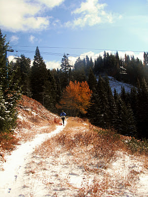 |
| B about a mile into her Brundage climb. |
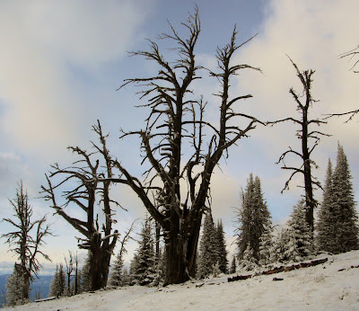 |
| These trees live tough lives. Withered and gnarly. |
 |
| The view west from Brundage's summit of the Crestline Trail and the Lick Creek Range behind. |
 |
| B nears the top as Granite Mountain looks on. |
 |
| B triumphant on top. |
Friday, November 4, 2011
More IMTUF 100 Recon: Ruby Meadows
A typical mountain day. Begin with a good cup of coffee. Gas up the chainsaw and head for the hills. Cut a truckload of wood. Then hit the trailhead. Today, it was the Ruby Meadows Trail near Burgdorf. This classic will surely be part of the Wild Idaho 100 race next fall. A driving snow only added to its character. This may be our last day before the roads to the high peaks close. If so, it was a great year of adventures.
 |
| B crosses the beautiful Ruby Meadows. |
 |
| Let it snow. |
 |
| Muleys enjoying the snow. Payette Lake backdrop. |
IMTUF 100 Recon: A Day on Bear Pete Mountain
B and I headed up to Burgdorf for another day of fun in the peaks. We climbed up Nethker Creek to the shoulder of the gigantic Bear Pete Mountain. Lots of great views and cold, windy weather greeted us on top. Winter is clearly on its way. A soothing soak in the World Famous Burgdorf Hotsprings finished off the day.
 |
| Climbing Nethker Creek Trail. |
 |
| Wolverine or Badger? The tracks clearly show 5 clawed toes- so not a bear, lion or wolf. I sent the pics to the Idaho Fish and Game, who are doing a wolverine study. We'll she what they say. |
 |
| Our summit for the day on the ridge. Black Tip, Bruin , Hard Butte and a myriad of other peaks to the Southwest. |
 |
| B motors along the ridge with views of the Salmon River breaks in the background. |
 |
| Ahhh Burgdorf. 100+F in the water and 20F out of it. |
 |
| Upper Payette Lake with the 20 Mile drainage (Left) and Storm Peak (Right) visable. |
 |
| Payette Lake at Dusk with Osprey Point of Ponderosa State Park. Lots of Tamaracks showing golden glory. |
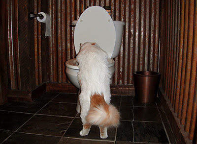 |
| Post run hydration is critical. Robie is keen on this. |
Wednesday, November 2, 2011
More IMTUF 100 Recon: Victor, Loon and Twenty Mile Creek Megaloop
 |
| Victor Creek Trail #117. Looking east toward the North Fork of the Payette River, Burgdorf and its surrounding peaks. |
 |
| Looking West from Diamond Ridge at Victor (L) and Storm (R) Peaks. |
 |
| Diamond Rock. Looks prime for some first ascents on golden granite. |
 |
| Victor Creek Trail heading toward Loon Lake. This is what I love about Idaho- you move between burned areas, Alpine ridges, to deep dark old growth forests. Never gets boring. |
 |
| Beginning the slog up Look Creek. Looking toward the big alpine peaks of North and South Loon . |
 |
| Higher into Loon Creek, meadows abound. |
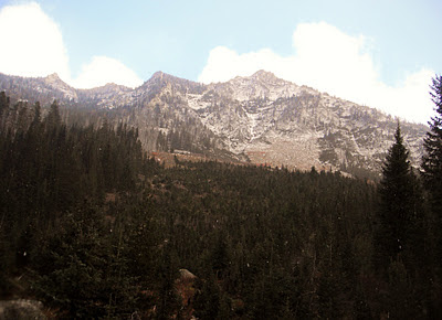 |
| The stunning west faces of the Loon Peaks. |
 |
| Twenty Mile Creek elk. Two young cows. |
 |
| The last traces of light capture the peaks I have traversed all day. |
Monday, October 31, 2011
2012 Scott eRide Grip: Review
Check 'em out here
History
I had been looking for a solid, 10-11 ounce trail runner all summer for some upcoming 50-100 mile races. While in Boise, at Shu's Idaho Running store, I spied these canary yellow "go-fasters" that looked like they were going to fly off the shelf and run. The 2011 Scott eRide Grip!
Scott- you mean like the ski goggle company? Turns out they are making running shoes and they are based right here in Idaho. Intrigued, I passed on the purchase, opting to go home and do some research. I called the Scott company and had a great conversation with Scott McCoubrey, the head of their running department. He answered all of my tech questions and I hung up ready to buy. I phoned in my order with Shu's right away.
I wore the yellow shoes in my 54 mile win and course record at Wild Idaho in August. However, because of some very fast downhilling, the strong toe guard on the eRides dinged up my toe nails. I called up Scott and told him of my success. He told me they were releasing the new 2012 model which has a softer toe guard. For full disclosure, I must tell you that the 2012 model was given to me by Scott.
History
I had been looking for a solid, 10-11 ounce trail runner all summer for some upcoming 50-100 mile races. While in Boise, at Shu's Idaho Running store, I spied these canary yellow "go-fasters" that looked like they were going to fly off the shelf and run. The 2011 Scott eRide Grip!
 |
| Spankin new hotrods! 2011 eRide. |
Scott- you mean like the ski goggle company? Turns out they are making running shoes and they are based right here in Idaho. Intrigued, I passed on the purchase, opting to go home and do some research. I called the Scott company and had a great conversation with Scott McCoubrey, the head of their running department. He answered all of my tech questions and I hung up ready to buy. I phoned in my order with Shu's right away.
I wore the yellow shoes in my 54 mile win and course record at Wild Idaho in August. However, because of some very fast downhilling, the strong toe guard on the eRides dinged up my toe nails. I called up Scott and told him of my success. He told me they were releasing the new 2012 model which has a softer toe guard. For full disclosure, I must tell you that the 2012 model was given to me by Scott.
 |
| A beauty- the 2012 with "ion-mask". 250 miles and still mint. |
Saturday, October 29, 2011
IMTUF 100 Mile Recon
Bloody Ben and I have decided to put our heads together and direct a real mountain 100 on my home turf in McCall. As the days of sunshine dwindle, I am scrambling to explore every possible "nook and cranny" of the peaks to deliver only the finest for our race. Here is a little sampling of what I have unearthed of late...
 |
| Payette Lake today. The Crestline Trail towers above to the west. |
 |
| War Eagle Lookout above Burgdorf |
 |
| Chimney Rock near War Eagle Lookout |
 |
| Burgdorf Hot Spring |
 |
| Bull Moose |
 |
| Beaver Dam Peak on the Crestline Trail as seen from Snowslide Trail |
 |
| Snowslide Lake with the towering granite walls of the North Face of Snowslide Peak. |
 |
| Alpine enough for you? |
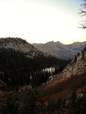 |
| Snowslide Lake and Crestline Trail peaks in the distance to the west. |
 |
| Fitsum Peak? Never seen this view before. Looking east from Snowslide saddle. |
 |
| Standard 15 mile "Runting" trip. High on the Boulder Mountain alpine pack trail. |
 |
| Awesome views of the McCall area and Long Valley. |
 |
| B heading for Boulder Mountain summit. |
 |
| B ponders the amazing Anderson Lake below Boulder Mountain. |
 |
| B chugging along as the Lick Creek Range spills out behind her. |
 |
| Blazing gold Tamaracks rival anything I remember from my days back east. Almost to the truck... |
Subscribe to:
Posts (Atom)

